Florida’s Finest Ambassador and Artist-in-Residence

“Nature is ever at work building and pulling down, creating and destroying, keeping everything whirling and flowing, allowing no rest but in rhythmical motion, chasing everything in endless song out of one beautiful form into another.” ~John Muir
I was honored to be invited to be the Artist-in-Residence for the Forgotten Coast en Plein Air this spring. My artist residency is split into two parts over three weeks. I spent 4 days on the Forgotten Coast of Florida last week and I will spend another 3 days there again next week, continuing to study and to paint the 2019 theme for Forgotten Coast en Plein Air, which is “Recovery in the Natural Environment” relative to the devastation wrought by Hurricane Michael in October of 2018. My personal approach to this project focuses on Hope.
I am hosted by a sweet couple, George and Maggie Jones on Cape San Blas, just a few miles south of St. Joseph Peninsula State Park. They didn’t see much of me while I was there last week because I was out every day, observing, painting, photographing, and absorbing, from first light until sunset.
The Conservation Corps of the Forgotten Coast
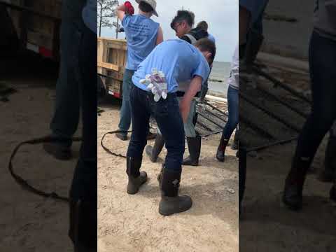
Joe Taylor, CEO of Franklin’s Promise Coalition, invited me to see the mitigation efforts of the Conservation Corps and Disaster Corps that were happening last week. Marquette High School (Rockwood School District, St. Louis, Missouri) sent 120 students to spend their spring break here to assist in hurricane recovery and mitigation. They were planting sea oats, building living shorelines, picking up trash, and helping to restore longleaf pine forests. Accompanied by teacher and staff volunteers and two principals, Dr. Dan Ramsey and Amy Blumenfeld, Marquette High School chose the Forgotten Coast for their service project this year.
When people are motivated and leadership is effective, a lot of work gets done. The Conservation Corps of the Forgotten Coast posted on their Facebook page, “What an awesome Spring Break! Our CCFC GulfCorps and Disaster Corps Crews hosted 120 of the most energetic and hard working teens from Marquette High School in St. Louis, MO. They completed 6 service projects in three days. They helped restore the dunes by planting sea oats on the beach behind the SGI Lighthouse, they rebuilt the living shoreline on Sawyer Street, they removed hurricane debris from Unit 4 (East Hole) on SGI, at the Apalachicola National Estuarine Research Reserve Visitor Center grounds, and throughout Tate’s Hell State Forest. And they cleaned, weeded, and layed fresh pine straw for the Reid Avenue businesses in Port St. Joe. They were such fun young people and they really worked hard to help our communities recover from Hurricane Michael.”
I was interested to learn that the leadership development for this effort is funded by the BP Deepwater Horizon Oil Spill settlement. The program crosses five states — Florida, Alabama, Mississippi, Louisiana, and Texas. The Forgotten Coast chapter and a chapter in Mississippi are the pilots, models for the others. I met crew manager Holden Foley who is one of these trained leaders. He was supervising one of the groups of students.
Per the website: “The GulfCorps initiative is a major part of The Corps Network’s activities on the Gulf Coast. Made possible by a $7 million RESTORE Act grant administered by the National Atmospheric and Oceanic Administration (NOAA), GulfCorps officially launched in August 2017. Over three years, funds will be distributed evenly to the five Gulf Coast states to support existing local Corps in hiring young adults to conduct restoration and conservation activities. The Corps Network, The Nature Conservancy (TNC) and the Student Conservation Association (SCA) will facilitate recruitment, training, and identification of projects. GulfCorps is expected to provide jobs to 300 young adults over the coming years.” ~CorpsNetwork.org
Planting Sea Oats
The first couple of days were cloudy or hazy, not the best light for plein air painting. I sketched a lot and took photos. I was impressed by how fast the job went when I watched the kids planting sea oats in front of the lighthouse on St. George Island. 4000 sea oats had been purchased, their root masses still in the shape of nursery pots. Holden, the crew leader, gave shovels to some of the kids and to some he gave plants, and some took the super-absorbent polymer, a product holding moisture which is placed in the bottom of the hole under the seedling root mass. The kids were models for us to see what we all can do to get along, cooperate, and do good in our community in real, impactful ways. Below are a few pages from my sketchbook.


Joe pointed out to me the difference that last year’s planting of sea oats had made. Even though some had washed away in Hurricane Michael, they greatly stabilized the foredune, versus the area in front of neighboring private property bordering the planted area. There, the berm was heavily scarped by erosion, forming a 4-foot cliff.

Construction of a Living Shoreline
The light was a little brighter the second day, so I was able to produce a plein air study of the students organizing into a “bucket brigade” to carry bagged oyster shells out to the living shoreline they were building on the Bay at Sawyer Street on St. George Island. A living shoreline is the placement of barriers in the Bay near the shore, which break the force of waves and trap sand brought in by wave action. The shoreline rebuilds as a result, eventually covered by cordgrass. Oyster shells are used because they are natural to the area. The students had loaded the shells into biodegradable mesh bags in an assembly line of shoveling, scraping, and tying. TURN DOWN YOUR VOLUME — it was windy that day.
Cait Snyder, the ANERR’s land management and stewardship specialist and advisor for the project, introduced herself to me and offered any research advice I might need. ANERR, the Apalachicola National Estuarine Research Reserve, focuses on scientific research, natural resource management and environmental education and stewardship and partners with local, state, and federal agencies for a multitude of projects.
Construction of a living shoreline requires a permit from the State and the Army Corps of Engineers, specifying where and how it will be built, with periodic gaps in the barrier so that the Bay critters and fish can swim back out with the tide. Where I stood when I set up to paint was exciting evidence of the success of prior barriers. Sand had accreted to a depth of more than a foot, and the spartina (Spartina alterniflora aka smooth cordgrass) had held up through Hurricane Michael, probably helping to prevent the road from being washed out. I visited with a local who thought the accreted dirt had come from the road. But I could see that the sand inside the living shoreline was very different from the dirt making up the road, so there was no confusion in my mind as to the Bay source of the sand. Cait told me that there even was a red mangrove tree coming up at the edge of the spartina, but that it didn’t appear to have survived the storm. I had no idea mangrove trees grew this far north. Cait said that historically red mangroves have existed in the northern Gulf, but have often been limited by cold events. She said fewer cold events, less intense temperatures, and shorter durations of freezing temps may be allowing mangrove expansion at the northern edge of their ranges in recent years.
Trash and Debris Collection
I also saw a couple of groups of the Marquette students cleaning up storm debris from ANERR Unit 4 on St. George Island and from Millender Park in Eastpoint. This task was very familiar to me, being the bulk of my own experience from cleaning up after tropical storms – there is so much trash, windblown, of course, and also waterborne by storm surge flooding. Hurricanes are giant mess-makers. The students had made piles of contractor bags full of trash, and grouped it into mountains for collection.
St. Joseph Peninsula State Park

Later that afternoon the sun came out, and I went to T.H. Stone Memorial St. Joseph Peninsula State Park to see the amazing breach again. I accidentally came upon a couple of deer, one full-grown, and the younger one nearly grown, certainly born last year, both of them survivors of the storm. They represent exactly the Hope I want to convey as my personal focus for the recovery theme of the residency, the reason I chose the John Muir quote to open this blog post.
Dawn brought bright sunshine on my third day there, and anticipating it, I was waiting at the entrance to the state park for the 8 AM opening of the gates. I was not disappointed. The area of the breach caused by Hurricane Michael’s storm surge has turned out to be a scenic wonder, different every time I see it. This morning, there were large tide pools on the Bay side, left by the tidal current running through the breach from the Bay to the Gulf. When time is fleeting, I use my phone-camera for my sketchbook. I took photos to document everything from the color of the water to the myriad of different kinds of ripples left in the tidal flats. I stood at the edge of the water for 20 minutes watching a new sand bar being formed, starting to enclose another small pool. Mother Nature was working to close the breach before my very eyes! I wonder how long it will take. When I first saw the breach 4 weeks ago, much of what had been a roiling hurricane current already was a sand flat, and this week I found the channel already only half as wide as it had been just four weeks ago. The sand on the Gulf side has piled up into a berm 4-feet thick. High winds of 18 to 20 mph overnight had glazed the plain of sand smooth as snow, with harrow marks where small shells dotted the surface.

I find the breach to be one of the most fascinating things I have ever seen, my imagination entranced by the majestic power of the Hurricane that carved through a peninsula hundreds of years old, perhaps thousands. The aerial imagery of the floor of the Bay in that area shows where a channel might have cut through before. Native American artifacts found there indicate activity over the length of the peninsula for a long time, but I guess they would have come on boats if the breach ever was open during their time on the peninsula. So I don’t know how old the peninsula is, or how long it’s been since it last was breached.

I stood my easel near the water’s edge to paint the far shore across the channel. I chose a small 6”x12” canvas because of the high winds. My study shows the old tree that was unburied by the sweeping storm surge, now standing alone by itself, a sentinel between the dunes and the channel. It seems to have a net or something hung up in its lowest branches, giving the trunk an odd silhouette. The early sun cast long shadows from the scarped dunes; they shortened while I was painting.
That afternoon I revisited St. George Island to see how the living shoreline looked with the sun shining, but when I got there, smoke from a distant fire was filtering the sunlight. I returned to Cape San Blas for cocktails and dinner with my hosts and their friends.
St. Vincent National Wildlife Refuge
On my last morning there, I took a walking tour on St. Vincent National Wildlife Refuge. I had registered for it on the Friends of SVNWR website a month prior. 30 people came across Indian Pass on the shuttle in 5 trips. We divided into several groups for the tour. The path we took skirted the protected bird-nesting area, winding up on the Gulf side of the island tip. The beach was flat where until Hurricane Michael, the guide told us, tall, 800-year-old dunes had protected the island. We walked inland over the 26’-elevation highest point and down to the old dirt logging roads. 70% of the island was inundated during the storm by a surge and waves of 13′. Most of the wildlife survived the storm, including the native deer, the exotic Sambar deer, and the recently introduced red wolf mates and their two pups. We saw lots of tracks showing the recent activity of deer, wild boars, and even the wolves. Happy birds filled the forest with the sounds of spring. It was a beautiful hike through natural Florida, slash pines mixed with swamps and palms, and wildflowers everywhere. I highly recommend it. Remember to bring mosquito repellent.

The Next Part of the Artist Residency
This week I have been reviewing my photos and thinking about what I would like to paint en plein air when I return for the second half of my residency next week. Wednesday, April 3, will be “Field Day”, when people can come watch or even paint along with me, and we will meet at the end of the day for show-and-tell and wine at Scallop Republic. I chose the breach in St. Joseph Peninsula State Park for the area I would like to paint on that day. I’d like to try two or three paintings. Registration for attendees is at https://forgottencoastculturalcoalition.wildapricot.org/event-3330246.
On Thursday of this week I will paint half a day, and the other half day I will take a class on Oyster Ecology at ANERR, where I hope to learn how Hurricane Michael affected the oyster industry in the imperiled Apalachicola Bay, and how it is recovering. On Friday I will paint and later that afternoon I will prepare to give a presentation to the Board of the Forgotten Coast Cultural Coalition which is funding this residency. The public is invited. My presentation will be at 6:30 Eastern Time at The Joe Center for the Arts, 201 Reid Avenue, Port St. Joe, FL 32456. After that I will have a month to refine my plein air paintings and to also produce studio works for the theme.
The Exhibit of My Residency Paintings
My residency work will be displayed at the Forgotten Coast en Plein Air May 3-May 12, 2019. For the first part of the event, the exhibit will be at Cal Allen’s Gallery at 109 Avenue B South, Carrabelle, FL 32322. I will give a presentation at the FCenPA reception there on Tuesday, May 7, 2019, at 6:30 pm. On Friday, May 10, 2019, my paintings will be moved to hang at the Fort Coombs Armory at the corner of 4th Street and Avenue D in Apalachicola, FL, for the Maecenas Dinner that evening and for the final day of the Forgotten Coast en Plein Air and the Collector’s Gala. Click HERE for the event schedule.
Stay tuned for my next blog post, “Forgotten Coast en Plein Air 2019: Florida’s Finest Ambassador and Artist-in-Residence, Part 3!”